


Chemin de St-Guilhem 4

cron
User

Length
26 km

Max alt
1397 m

Uphill gradient
384 m
Km-Effort
34 km

Min alt
523 m

Downhill gradient
1146 m
Boucle
No
Creation date :
2019-01-15 16:40:23.905
Updated on :
2019-01-15 16:40:23.905
6h51
Difficulty : Medium

FREE GPS app for hiking
 SityTrail
IGN / Geographical institutes
SityTrail Plus
The world is yours!
About
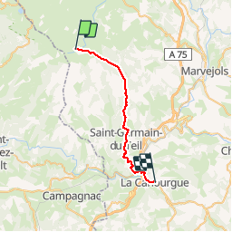
Trail Walking of 26 km to be discovered at Occitania, Lozère, Les Salces. This trail is proposed by cron.
Positioning
Country:
France
Region :
Occitania
Department/Province :
Lozère
Municipality :
Les Salces
Location:
Unknown
Start:(Dec)
Start:(UTM)
507429 ; 4935867 (31T) N.
Comments